CANADA & MEXICO: | |
|
41. Quebec City, Quebec:
|
Well known for its 2000 ft vertical winter ski drop, the Park is alive with summer visitors as well. Every year more than a million pilgrims visit the Basilica in the small, nearby town of St.-Anne-de-Beaupre, where is kept what is believed to be the forearm bone of the mother of the Virgin Mary. Pray for clear skies, then head out to the Mountain to search for the North Star. Directions: Exiting Ile-d’Orleans, turn right (east) onto Hwy 138 (boulv. St.Anne). Pass Montmorency Falls, another 20 km along 138. |
|
42. Toronto, Ontario:
|
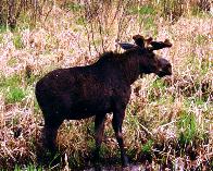
Algonquin Park is the oldest and the most famous provincial park in Ontario and one of the largest in Canada. Stretching across 7,725 sq. km of wild and beautiful lakes and forests, bogs and rivers, cliffs and beaches, it’s a canoeist’s and camper’s paradise. Directions: The eastern gate to Algonquin Park is 75 km north of Bancroft via Hwy 62, N to 127, on to 60 west. 401 east to 62, north to Bancroft. |
|
43. Winnipeg, Manitoba:
|
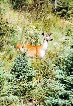
This island was once home to Icelandic settlers, and much of their original homestead has been restored. Still, most of the park has never seen development of any kind, so that a visitor feels they’ve stepped into the Middle Ages. The eerie Grassy Narrows Marsh adds to the vibe. Directions: Hwy 8 north straight up (over a bridge to the island). |
|
44. Montreal, Quebec:
|
According to an Amerindian legend, the Algonquins, installed here in the 17th Century had named the mountain “Manitou Ewitchi Saga,” or mountain of the dreaded Manitou, the Amerindian god of nature who made the mountain tremble when man dared disturb nature. Although it is busiest in winter (major skiing), year ‘round the summit of Mont-Tremblant commands a spectacular panorama of lakes, valleys and forests. Directions: 144 km (90 miles, 1 ½ hours) Take the Laurentian Autoroute (route15 North), until the very end and continue on route 117 North. Approx. 2 miles past St. Jovite, turn right onto Mont e Ryan Road. After 5 km turn left at traffic lights and continue into the village of Mont Tremblant; turn right and drive approx. 3 km for Gray Rocks. |
|
45. Vancouver, British Columbia:
|
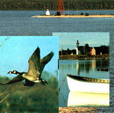
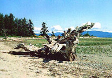
Located just off of the Trans-Canada Highway between Mill Bay and Victoria, the Bamberton Provincial Park on Vancouver Island offers a campground in a forest of arbutus, and good beaches fronting into the Saanich Inlet. After taking in the stunning views of the Saanich Peninsula, Gulf Islands and Mount Baker from the park, continue on into Victoria to see the stars at Dominion Astrophysical Laboratory. Directions: Cross to Vancouver Island, 19 south, turns into 18; through Bamberton, on into Victoria. |
|
46. Mexico City:
|
Fifteen hundred years ago, this was one of the largest cities in the world. This place, “where men become gods” as the Aztecs would say, is the great archeological site of Mexico. It sports the ‘Temple of the Sun’ and the ‘Temple of the Moon’, great paeans to the heavens. Be forewarned: its cold and often windy at night, and the actual museum is closed by five. Directions: About 60 km northeast of the city on 138. |
|
47. Guadalajara:
|
A tiny town on Mexico’s largest lake (Lake Chalapa), Ajijic is one of a constellation of small towns in the area well known for its international expatriate community. D.H. Lawrence polished off a novel or two here, and to this day the place is still crammed with hideouts and refuge artists. Good place to contemplate the starfields. Directions: 42 km south of Guadalajara. Best to take the bus (leaves every half hour from the Antigua bus station; a 45 minute ride). |
|
48. Monterrey:
|
Though Saltillo is a pretty big city in its own right, the city limits end at the mountains around it. Here, young Galileans can drive up into the jagged Sierra Madre and commune with the Milky Way. Directions: Take the train ‘El Regiomontano’ (Train 72) which leaves for México City at 7.50 p.m., and calls at Saltillo along the way. |
|
49. Chihuahua:
|
The Copper Canyons or Sierra Tarahumara are part of the Great Mountainous massif of the Western Sierra Madre. It’s world famous for the depth of its vast complex of six canyons and for the Raramuri (or Tarahumara) culture, which has remained intact despite the impact of Modern Mexican culture. A fine setting for a sweep of the cosmos (before a decent into the depths of the earth). Directions: The best idea is to hop aboard the Copper Canyon Railway and ride out to the heart of the Sierra Madre. |
|
50. Tijuana:
|
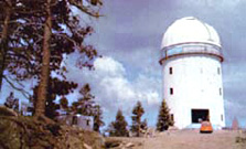
Ensenada, Baja California; 63,000 hectares En el Pico del Diablo (o Picacho del Diablo, como también es conocido), se ubica el Observatorio Astronómico Nacional instalado por la UNAM, la SARH y el Gobierno de Baja California. En 1971 colocaron los primeros telescopios en la cima; Arcadio Poveda, entonces director del Instituto de Astronomía de la UNAM, promovió la construcción de esos instrumentos en México. Ocho años después de haber instalado el primer telescopio y de haberse cumplido el primer centenario de la astronomía formal en México (el 5 de mayo de 1878, Porfirio Dlaz inauguró el primer Observatorio Nacional Astronómico), se inaugura oficialmente este observatorio (1979). Direcciones: 108 km south of Tijuana on Rte1. |
© 2012 Bernard Friedman